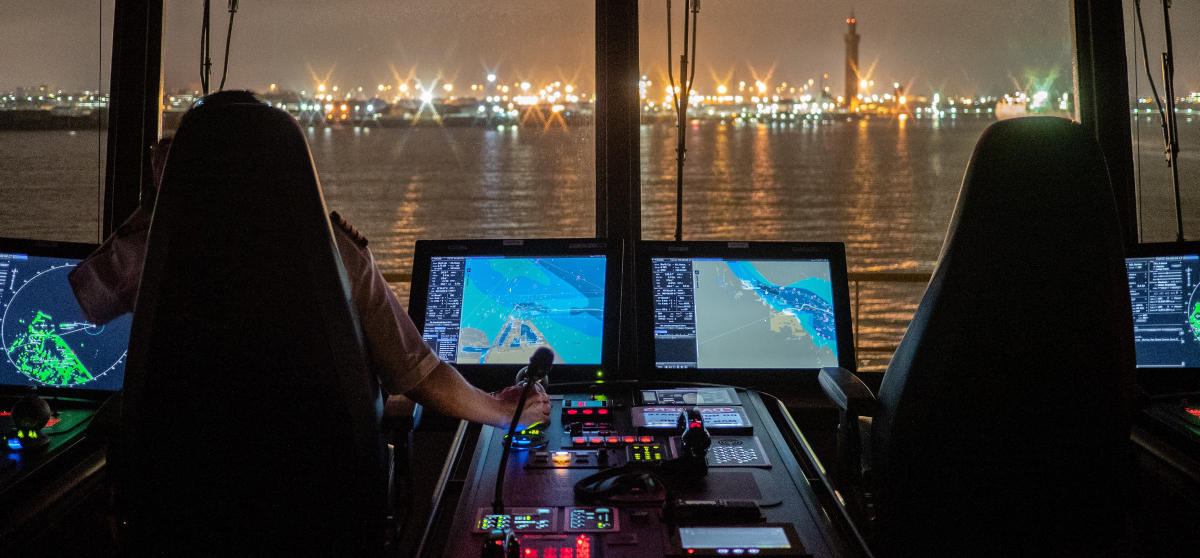
An Electronic Chart Display and Information System (ECDIS) is a geographic information system used for nautical navigation which today is found on many vessels. To replace paper maps, it is required that official maps (Electronic Nautical Chart, ENC) are used.
Examples
In the first three examples below, Navi-Planner is used as a route planning system. Navi-Planner is connected to ECDIS.
- A vessel was entering an area, and afterwards, the company received a message from the VTS saying that the vessel had come very close to a bank.
The voyage was planned in Navi-Planner (which uses ECDIS as a base), and the vessel sailed within its XTD (Cross Track Distance; the extremeties of the fairway where it is possible to sail).
Due to many things happening on the bridge at the same time (such as communication with external parties, documentation prior to arrival, load planning, ordering a pilot), the alarms in Navi-Planner were not observed or considered. So the route was planned over the bank, and sheer luck prevented the vessel from touching ground.
- While navigating out of an area where the voyage was planned, the mate decided to take a short cut to save time and fuel. For that reason, he sailed a short distance outside his XTD. Here too, sheer luck meant that the vessel avoided hitting a bank.
Only the areas with an XTD are estimated and controlled by Navi-Planner during a route planning process. This is the reason why the vessel should only go within its XTD during the voyage. For exceptions, new calculations must be made according to an alternative plan.
- When the pilot boarded the vessel, he noticed that the ECDIS map had not been updated for the route they had just sailed. The track showed that the vessel had, by chance, avoided dangerous underwater reefs only by a few metres.
It could also be a user error since only one basic layer or level was used in ECDIS instead of all the necessary levels. This means that the levels in the map displaying hazards could be hidden behind the main map. The basic level of ECDIS, or the "main map" can not provide the full picture of a hazardous situation, as it presents limited information.
It is important to make sure that all levels of the ECDIS map are visible, and that the system is restarted or updated regularly so that you have the latest updates.
- In the fourth example, it seemed as if a previously planned sailing route was loaded into ECDIS, but the vessel was not really intended to follow that route. Maintenance work was carried out on the engine, and they wanted to go in calmer waters. This led to a grounding, and out of pure luck there was no water intrusion or total loss. The vessel did, however, have to stay one month at a yard for repairs.
When they deviated from the sailing schedule, several mistakes or unfortunate circumstances occured. Firstly, they did not plan the new voyage. Secondly, they reported that the course vector in the charts had hidden the relevant bank, and no alarm was received from the system.
For the course vector to be able to hide a bank, it is very likely that the map was zoomed out too much. Also, the navigation can not be based on alarms from ECDIS or on confidence in the alarms to prevent groundings. In addition to errors that may occur, there is also the possibility of user errors related to alarms. The alarm may have been switched off, which could happen to avoid repeated alarms in a workshop or in port. The alarm settings may have also been changed to a certain depth and not reset.
Summary:
- Familarisation. The crew must have satisfactory knowledge of the functions and how the ECDIS system works, in addition to the requirements set out by the shipping company/captain as standards for the safe use of ECDIS.
- Make sure you use the recommended settings in ECDIS for functions such as zoom, alarms and the anti-grounding system.
- Route planning. Follow the planned route (within the ECDIS safety corridor). If changes need to be made to the planned route, the route must be planned one more time.
- Follow procedures and stay focused while planning the voyage. Do not let yourself be distracted by other things that need to be done. If necessary, the vessel should be stopped to take the time to plan the voyage ahead, in accordance with procedures and good seamanship.
- Make sure there is an updated map system available, and that you have the necessary levels in the ECDIS map.
- Keep an eye out and pay attention even if the route is planned!
And one more thing:
If the vessel has a VDR (Voyage Data Recorder, for passenger ships and other vessels over 3000BT), make sure this is activated should an incident occur. This lets you go back to read and learn from what went wrong. It is far better for everyone to learn from an incident rather than covering up or minimising mistakes. There is not much to learn if the mistake is covered up, and more incidents may occur.